
Whittier ZIP Code Coverage
Whittier's postal area is best read as six physical delivery areas plus four non-geographic or PO-box schemes. The county research identifies 90601 through 90606 as physical delivery areas, but several cross municipal or unincorporated lines. The rows below keep the postal facts separate from city jurisdiction. A post-office label is a routing clue, not proof that a parcel sits inside incorporated Whittier.
| ZIP | Areas Covered | Post Office | Notes |
|---|---|---|---|
| 90601 | Whittier, unincorporated Whittier, Industry, Pico Rivera, Sunrise Village | Whittier delivery | Crosses governments; northwest, hills, and Rose Hills context |
| 90602 | Central and Uptown Whittier, civic center | Whittier delivery | Principally incorporated central city |
| 90603 | Eastern Whittier, Whittwood, Friendly Hills vicinity | Whittier delivery | Physical delivery area |
| 90604 | South Whittier, East Whittier, incorporated Whittier, East La Mirada | Whittier delivery | Large postal area outside the city line |
| 90605 | Incorporated and South Whittier | Michigan Ave station | Michigan Ave station, 8520 Michigan Ave; multi-jurisdiction delivery |
| 90606 | West Whittier, Los Nietos, incorporated Whittier, Santa Fe Springs | Whittier delivery | Crosses the city line |
| 90607 | Whittier PO boxes | Whittier PO boxes | Non-geographic context; verify current USPS assignment |
| 90608 | Whittier postal non-geographic or PO-box scheme | Whittier postal scheme | Current citywide type table was not crawlable; verify |
| 90609 | Whittwood PO boxes | Whittwood PO boxes | Non-geographic context |
| 90610 | Whittier postal non-geographic or PO-box scheme | Whittier postal scheme | Verify current assignment before treating it as an address area |
The documented post-office detail is uneven by ZIP, so a current address should be checked in the USPS address ZIP lookup. The USPS ZIP information page is the broader entry point for delivery-code guidance. It is more accurate to say that USPS serves a route than to invent a station name that the source did not verify.
The captured USPS address lookup is the right reference point for a live mailing assignment.
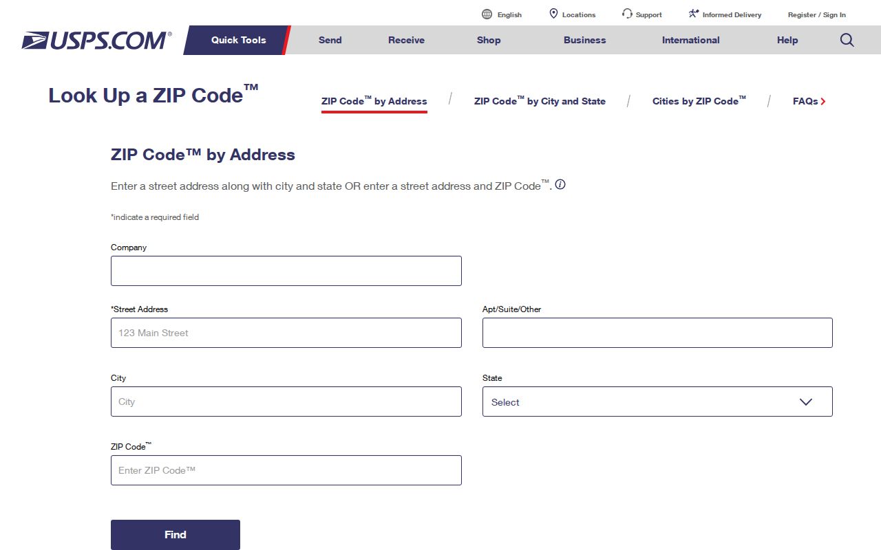
The USPS screen supports the delivery check, while the county parcel tools answer the separate question of where the land lies.
Whittier ZIP Delivery Areas
The physical codes 90601 through 90606 carry delivery in and around Whittier. The pattern is not a clean city slice. 90601 reaches Industry and Pico Rivera, 90604 reaches East La Mirada, 90605 includes South Whittier, and 90606 reaches Santa Fe Springs and Los Nietos. Even 90601's Whittier mailing city can describe land outside the incorporated city.
Central and Uptown Whittier are principally associated with 90602, while 90603 points toward the eastern side, including the Whittwood and Friendly Hills vicinity. Those descriptions help orient a search, but they do not replace an Assessor situs search. The city area is a legal and civic question. The postal code is a delivery question.
For each match, keep the delivery label beside the municipal label. The same research note may need to name Whittier, Los Angeles County, and a neighboring city before the correct custodian is clear.
That distinction matters for a resident directory. A ZIP result may mix incorporated Whittier with county land, Industry, Pico Rivera, East La Mirada, or Santa Fe Springs. Keep the exact address, municipality, AIN, and record custodian together when a match matters.
Whittier PO-Box ZIP Review
90607, 90608, 90609, and 90610 are not presented as ordinary geographic neighborhoods in the research. 90607 is tied to Whittier PO boxes, 90609 to Whittwood PO boxes, and 90608 and 90610 to non-geographic or PO-box schemes whose current citywide type table was not crawlable. They should not be used as if they draw a map around a group of homes.
A PO-box ZIP can identify where mail is collected without identifying a street parcel. A person, organization, or family-history record may therefore have a postal clue but no physical site to place on the Assessor Parcel Viewer. Verify the full address in USPS, then decide whether the next record is a parcel, a city archive, a library item, or a county file.
Note: The research does not verify a unique institutional ZIP in Whittier, so no single-facility ZIP is added to the directory.
Whittier ZIP Search Fields Expose the Limit
The Los Angeles County Assessor Portal is useful after a ZIP check, but its documented search route is an address or AIN route, not a ZIP-wide resident list. The portal offers Basic Search, Legal Search, Map Search, and Assessor Internet modes. Its public web view withholds owner and mailing address data; those facts are available through the East District counter or Property Data Sales route.
| Field label | Type | Required | Options or format notes |
|---|---|---|---|
| Search by AIN or Address | Text or autocomplete | One route | Enter a 10-digit AIN or a situs address |
| Search mode | Mode choice | No | Basic, Legal, Map, or Assessor Internet |
| ZIP-wide filter | Not documented | No | No official ZIP-wide assessor result set was found |
| Owner-name search | Not offered online | No | Use the counter or Property Data Sales for the tax-roll route |
The field table is why a ZIP code directory should not promise a countywide list of names. Use USPS to confirm delivery, the Assessor to identify a parcel, and the recorder or library when the question moves beyond present parcel facts.
Finding Whittier Residents by ZIP Code
A ZIP-keyed search works as a narrowing method, not as one universal database query. California's voter systems show the same limit. LA County voter self-verification requires last name, birthdate, house number, and ZIP. It is designed for an authenticated person's own status, not for browsing everyone at a ZIP.
- Enter the full mailing address in USPS and record the ZIP that USPS returns. Do not infer a ZIP from a city name alone.
- Use the Assessor Portal with the situs address or AIN. Note the parcel shape, legal description, event clues, and map links; do not treat the web result as a public occupant roll.
- For a voter question, use the LA County or California self-check only for the person who can provide the required identity fields. A full voter file requires an approved purpose under Elections Code sections 2188 and 2194, and protected voters are excluded.
- When a ZIP narrows the area to streets, keep the exact municipality and AIN, then move to the address-level records described in the Whittier street directory.
The Assessor and Treasurer and Tax Collector use situs or AIN keys. Whittier's permit flow uses Street No. and Street Name, followed by match selection. None of those documented routes supplies a ZIP-wide resident browse.
Whittier ZIP Boundaries and City Lines
ZIP boundaries and municipal boundaries answer different questions. A Whittier mailing address may be in unincorporated Los Angeles County, Pico Rivera, Santa Fe Springs, Industry, or East La Mirada. Conversely, a parcel associated with incorporated Whittier may need a postal check that does not match a reader's assumption about the city name.
Boundary check. Use USPS for delivery, then use the Los Angeles County Assessor Parcel Viewer or City of Whittier map resources for jurisdiction, parcel shape, districts, and land-use context. A postal label alone does not establish the city boundary.
The city map gallery can add council districts, vote centers, water districts, zoning and land use, hazards, policing geography, street sweeping, trash, Uptown, and other service layers. Those layers describe place. They do not turn a ZIP into a named resident or owner file.
Whittier ZCTA Slivers Are Statistical
Census ZCTA geometry may show small intersections with Whittier for 90631, 90670, or 91733. Those are statistical areas created for Census tabulation. They are not additional Whittier delivery codes, and they should not be added to a postal directory as if USPS had created new city routes.
The research does not corroborate 90612 as a Whittier ZIP. A map that colors a sliver can be useful for demographic comparison, but it cannot change the address-to-ZIP answer returned by USPS or the legal parcel answer returned by the Assessor.
For a historical question, preserve the source type. A ZCTA boundary is not a postal assignment, an AIN, a tract and lot description, or a city annexation line. Mixing those layers creates false matches.
Whittier ZIP Research After 1966
Whittier's entire street-number system changed in 1966 to the Los Angeles County system. Before the change, direction mattered. Duplicate numbers could be separated by north and south, such as 102 N Greenleaf and 102 S Greenleaf. A modern ZIP search can therefore locate the right delivery area while a historical directory search still misses the old address.
Whittier expanded after incorporation in 1898, and the 1961 annexation added more than 28,000 people. Postal geography, city growth, and the county number conversion do not share one date. When a pre-1966 address appears in a deed, directory, tax ledger, or newspaper, retain its direction and search both abbreviated and spelled-out street forms.
An AIN, tract and lot, parcel map, or legal description is a stronger bridge than street text. A postal code routes a letter. A legal description anchors land. That is why the postal directory hands old address work to parcel and historical sources rather than treating postal text as permanent.
Note: A 1966 number change can break a name, address, and ZIP search even when the parcel itself never moved.
Whittier Postal Terms
Four terms keep ZIP research from drifting into claims the records cannot support.
- ZIP versus ZIP+4
- A postal code is the five-digit delivery area. ZIP+4 adds four digits that narrow routing within that delivery system; it does not create a city boundary.
- PO-box ZIP
- A postal code used for post-office boxes or another non-geographic scheme. It can identify a mailing point without identifying a street parcel.
- Unique ZIP
- A ZIP assigned to one organization, facility, or other narrow recipient group. The research does not establish one for Whittier's listed codes.
- Carrier route
- A mail-carrier delivery path inside a postal area. It is more granular than a ZIP, but it is not a public household directory.